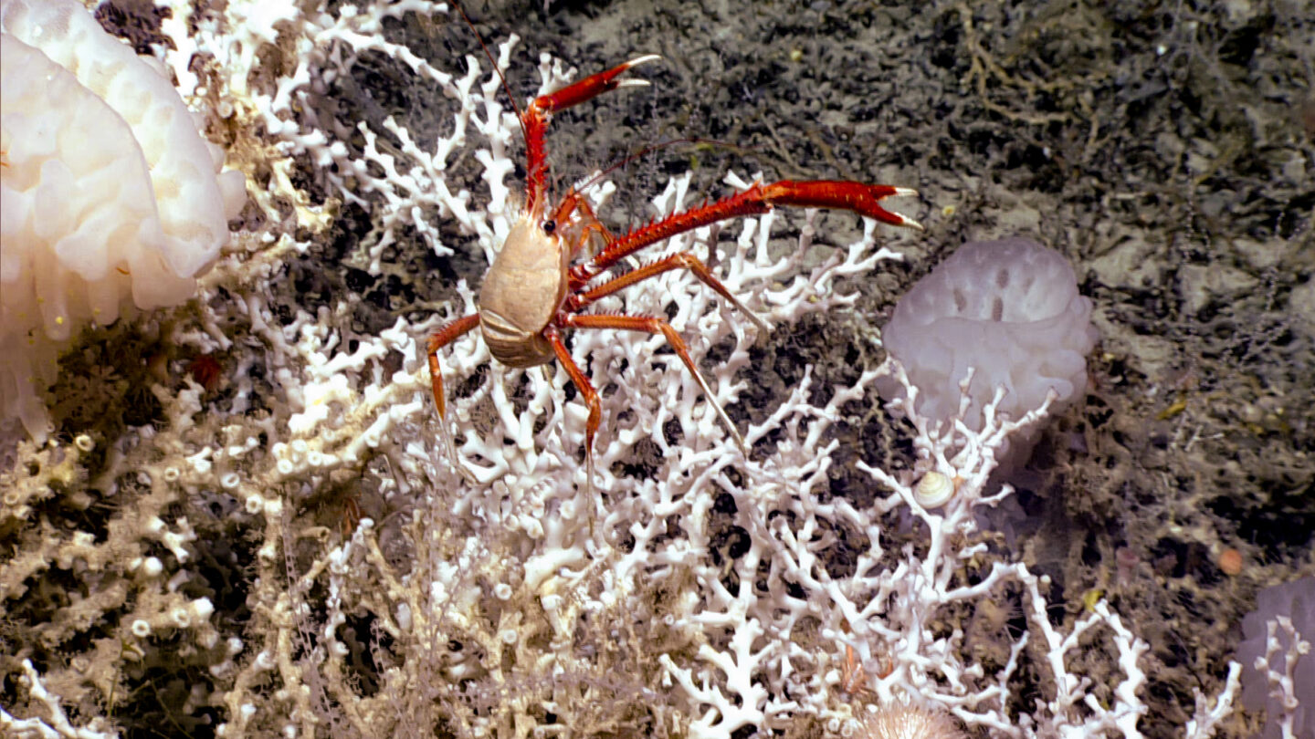
The largest-known deep sea coral system on Earth is just off the coast of Georgia and other southern states.
Mounds of white coral rise up from the Blake Plateau half a mile below the surface of the Atlantic Ocean. The habitat hosts fish, crabs, shrimp, sea anemones, jellyfish and squid.
People have known about the coral here for decades, but scientists only recently realized the scale of it. In a paper published in the journal Geomatics, a team of researchers describe what they call a deep sea coral province spanning an area about the size of the state of Vermont.
“It was kind of astounding,” said Derek Sowers, an oceanographer and mapping operations manager at the Ocean Exploration Trust.
He’s the lead author of the study that pulls together many years’ worth of mapping, deep sea diving and computer analysis.
“It’s not like we didn’t expect to see corals here,” he said. “It’s just, we didn’t know the extent — how many coral mounds there were.”
Courtesy of NOAA Ocean Exploration
Using an automated process developed at the University of New Hampshire, the scientists estimate the area has nearly 84,000 coral mounds — hills of coral rising up an average of 65 feet from the sea floor.
The area with the most continuous mounds is more than 300 miles long and close to 70 miles wide. It lies between 35 and 75 miles off the coast, according to the researchers, stretching from the coast of Florida to the coast of South Carolina.
“We kept mapping further and further offshore, and we kept not finding the edge of the habitat,” said Kasey Cantwell, operations chief for NOAA Ocean Exploration, who also contributed to the new paper. “Each year we kept going on, being like, ‘This is the year we’re going to find the end.’ And we didn’t for many years.”
This is a separate coral habitat from the protected Gray’s Reef National Marine Sanctuary, which is shallower and closer to the Georgia coast, near Sapelo Island.
Most of the deep sea coral area is also already protected by the South Atlantic Fisheries Management Council from some activities that might affect the sea floor or damage the coral — things like ships anchoring, or trawling — though it does not have say over any potential future oil, gas, or mineral development.
For the mapping project, NOAA worked closely with people from other agencies, universities and non-profits. They conducted more than a dozen research expeditions, and pulled in additional data from multibeam sonar mounted on ships and deep sea dives in manned and unmanned submersibles.
Sowers said exploration like this is vital for advancing marine science.
“There’s much to be discovered out there,” he said. “About 75% of the world has yet to be mapped in higher resolution like presented in this study. And only about 50% of the U.S. waters have been mapped in high resolution.”
He said he hoped the research — and the way they did the research — will open up new horizons for scientists.
Courtesy of NOAA Ocean Exploration
That includes, potentially, finding even larger deep sea coral provinces that are out there waiting to be discovered, Cantwell said.
“This is our backyard,” Cantwell said. “I really like projects like this, because it shows us just how little we are. And it’s kind of humbling for how much we still have to learn.”