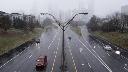
This Martin Luther King Jr. weekend will bring with it a major winter storm, potentially delivering several inches of snow to southern states that aren’t used to it.
Here in Georgia, the northeast portion of the state is expected to experience the highest amounts of snowfall and ice beginning in the early Sunday morning hours. Heavy amounts of precipitation is in the forecast for metro Atlanta which has the potential bring some snowflakes to the area.
Wind gusts throughout northeast Georgia and metro Atlanta are also expected to be a factor over the weekend.
The greatest snowfall could fall over west Tennessee and northern Mississippi, with some areas seeing more than six inches of accumulation.
The gathering storm has states on edge, especially after last week’s snowfall that snarled traffic and stranded drivers on I-95 for hours.
Virginia, Georgia, North Carolina and South Carolina have all declared states of emergency ahead of the approaching storm. The Virginia State Police cautioned drivers to keep the storm in mind while making travel plans.
Outgoing Virginia Gov. Ralph Northam declared a state of emergency Friday in advance of the storm, not just to give emergency responders a chance to prepare but also because the declaration “gives Governor-elect [Glenn] Youngkin the ability to respond to any storm needs swiftly,” Northam said.
Stores, already sporting empty shelves due to bad weather, supply chain issues, and COVID-caused labor shortages, are facing more demand as people stock up ahead of the storm. Hardware stores around the region were reporting higher-than-usual demand.
Dwight Gilleland, owner of Dawsonville Hardware north of Atlanta, told the Associated Press he was out of heaters by noon Friday and had only five bags of salt and sand left. “I think the pandemic has made people more anxious than normal,” he said.
Up to four inches of snow is possible north of central Mississippi, near the Tennessee state line. The Jackson, Miss., weather forecast office warns of sustained winds of 20-25 mph, gusting to 40 mph at times, potentially downing trees and causing power outages.
Government agencies were urging potential motorists to stay off the roads in the face of heavy snow and gusty winds. “Travel will be dangerous!” the Memphis National Weather Service office said, forecasting snowfall totals of 4-6 inches along the I-40 corridor and into the Mississippi Delta. “Power outages are possible!!!”
The storm may even bring snow to areas that don’t normally see it, such as southern Mississippi and the Tennessee Valley, the National Weather Service says. It says rain will transition to snow by early Sunday morning across some of northeast Louisiana and southeast Arkansas, with up to two inches of accumulation possible.
This winter storm is “poised to produce significant snowfall totals from the Tennessee Valley to Southern Appalachians and dangerously icy conditions in the Carolina Piedmont and far northwest Georgia tonight and into Sunday morning,” the NWS Weather Prediction Center said
This weekend’s weather is part of a storm that already dropped heavy snow across the Midwest, including up to a foot in parts of northern North Dakota and western Minnesota. Des Moines, Iowa, saw a new daily record of nearly 10 inches.
On Sunday, the storm is expected to continue up into the Mid-Atlantic as it heads north, bringing sleet and rain along the Eastern seaboard.Copyright 2022 NPR. To see more, visit https://www.npr.org.9(MDAxODM0MDY4MDEyMTY4NDA3MzI3YjkzMw004)) WABE contributed to this report.
WABE contributed to this report.

9(MDAxODM0MDY4MDEyMTY4NDA3MzI3YjkzMw004)) WABE contributed to this report.
WABE contributed to this report.


