A local non-profit is looking to give Georgia’s rivers the digital treatment.
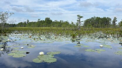
Georgia River Network is partnering with the company Earthviews to create 360-degree maps of Georgia’s waterways.
Since February, GRN has mapped out 300 miles of Georgia’s rivers using GoPro Camera kits supplied by Earthviews.
“There’s 70,000 miles of rivers and streams in Georgia, so it’s a drop in the bucket,” says GRN’s Paddle Georgia Coordinator, Joe Cook. “But before the end of the year, we’ll have four to five hundred miles of rivers documented in this Google Street View style.”
The GoPro Cameras are programmed to take photos every 10 seconds. Over the course of a trip, the cameras can take anywhere from 1,000-2,000 images. These images are then stitched together using specialized software to create a 360-degree view of the scene.


