Tropical Storm Nicole churned toward the northwestern Bahamas and Florida’s Atlantic coastline on Tuesday and was forecast to develop into a hurricane over the next couple of days, forecasters said.
A range of warnings and watches remain in place. Many areas are still reeling from damage caused by Hurricane Ian, which hit Florida’s southwestern Gulf Coast as a Category 4 storm in late September before dumping heavy amounts of rain across much of the central part of the state. Forecasters said heavy rain could fall on areas still recovering from Ian’s flooding.
Hurricane warnings were in effect for the Abacos, Berry Islands, Bimini and Grand Bahama Island, the Miami-based National Hurricane Center said in an advisory. Other areas of the Bahamas, including Andros Island, New Province and Eleuthera remained under a tropical storm warning.
Residents in at least three Florida counties — Flagler, Palm Beach and Volusia — were ordered to evacuate from barrier islands, low-lying areas and mobile homes. The evacuation orders are set to take effect Wednesday. Officials at Orlando International Airport, the seventh busiest in the U.S., said commercial operations would stop Wednesday afternoon until it was safe to resume flights.
“This incoming storm is a direct threat to both property and life,” said Volusia County Manager George Recktenwald. “Our infrastructure, particularly along the coastline, is very vulnerable because of Hurricane Ian.”
In the Bahamas, long lines formed at gas stations and grocery stores earlier Tuesday, said Eliane Hall, who works at a hotel in Great Abaco island.
“We just boarded it up,” she said of the hotel, adding that the impact of Hurricane Dorian, a Category 5 storm that struck in 2019, was still fresh in many people’s minds. “We’re still affected,” she said.
Authorities said they were especially concerned about those now living in about 100 motorhomes in Grand Bahama after Dorian destroyed their homes, and about the migrant community in Great Abaco’s March Harbor that Russell said has grown from 50 acres (20 hectares) to 200 acres (81 hectares) since Dorian. The previous community of Haitian migrants was among the hardest hit by the 2019 storm given the large number of flimsy structures in which many lived.
The storm should reach Florida late Wednesday or early Thursday
The hurricane center said the storm’s track shifted slightly north overnight, but the exact path remains uncertain as it approaches Florida, where it is expected to make landfall as a Category 1 hurricane late Wednesday or early Thursday.
By Tuesday afternoon, hurricane warnings were issued for a large portion of Florida’s Atlantic Coast, from Boca Raton to north of Daytona Beach. Tropical storm warnings are in place for other parts of the Florida coast, all the way to Altamaha Sound, Georgia. The warning area also stretches inland, covering Florida’s Lake Okeechobee, with tropical storm watches in effect on the state’s Gulf Coast from Bonita Beach in southwestern Florida to the Ochlockonee River in the Panhandle. The tropical storm watch extends north to the South Santee River in South Carolina.
Bevin said the storm has a “very large cyclonic envelope,” meaning that even if it makes landfall along the central Florida coastline, the effects will be felt as far north as Georgia.
However, the storm was not expected to have any impact on voting in Florida on Tuesday, Bevin said.
Parts of the Bahamas will receive a direct hit from the storm
Officials in the Bahamas opened more than two dozen shelters across the archipelago on Tuesday as they closed schools and government offices in Abaco, Bimini, the Berry Islands and Grand Bahama.
Authorities warned that airports and seaports will close as the storm nears and not reopen until Thursday, and they urged people in shantytowns to seek secure shelter.
Communities in Abaco are expected to receive a direct hit from Nicole as they still struggle to recover from Dorian.
“We don’t have time to beg and plead for persons to move,” said Capt. Stephen Russell, emergency management authority director.
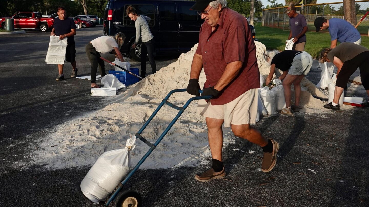
Some counties in Florida were offering sandbags to residents. In Indian River County, which is north of West Palm Beach, shelters were set to open at 7 a.m. Wednesday, though no mandatory evacuation orders had been issued by late morning Tuesday, said spokesman Mason Kozac.
Any evacuations would be strictly voluntary, with residents “having a conversation with themselves about whether they need to leave or not,” Kozac said.
The mandatory evacuation order in Palm Beach County affects 52,000 residents of mobile homes and 67,000 residents of barrier islands, officials said in an afternoon news conference. Shelters up and down the coast were opening at 7 a.m. Wednesday, officials said.
Schools will be closed in multiple counties across Florida as the storm approaches. Some announced closures through Friday, already an off day because of the Veteran’s Day holiday. Other districts have said they would cancel classes on Thursday. The University of Central Florida, one of the largest U.S. universities with 70,000 students and 12,000 employees, was closing on Wednesday and Thursday.
Disney World outside Orlando planned to close its Typhoon Lagoon water park and two miniature golf courses on Thursday.
In Seminole County, north of Orlando, Hurricane Ian caused unprecedented flooding, and officials are concerned the impending storm could bring a new round of flooding and wind damage.
“The water on the ground has saturated the root structures of many trees. The winds could bring down trees and those could bring down power lines,” Alan Harris, Seminole County’s emergency manager, said at a Tuesday news conference.
In South Carolina, forecasters warned several days of onshore winds from Nicole could pile seawater into places like downtown Charleston. Thursday morning’s high tide was predicted to be higher than the water level from Hurricane Ian.
At 4 p.m. Tuesday, the storm was about 285 miles (460 kilometers) northeast of the northwestern Bahamas and 395 miles (640 kilometers) east of West Palm Beach, Florida. It was moving at moving at 10 mph (17 kph), with maximum sustained winds up to 65 mph (100 kph).
Tropical storm-force winds extend outward up to 380 miles (610 kilometers) from the center of the storm, the National Hurricane Center’s advisory said.
The Atlantic hurricane season runs from June 1 through Nov. 30. The last storm to hit Florida in November was Tropical Storm Eta, which made landfall in Cedar Key, on the state’s Gulf Coast, on Nov. 12, 2020.
Since record keeping began in 1853, Florida has had only two hurricanes make landfall in November, said Maria Torres, a spokesperson for the Hurricane Center. The first was the Yankee Hurricane in 1935, and the second was Hurricane Kate, which struck Florida’s Panhandle as a Category 2 storm in 1985.
Copyright 2022 NPR. To see more, visit https://www.npr.org.
9(MDAxODM0MDY4MDEyMTY4NDA3MzI3YjkzMw004))

9(MDAxODM0MDY4MDEyMTY4NDA3MzI3YjkzMw004))


